


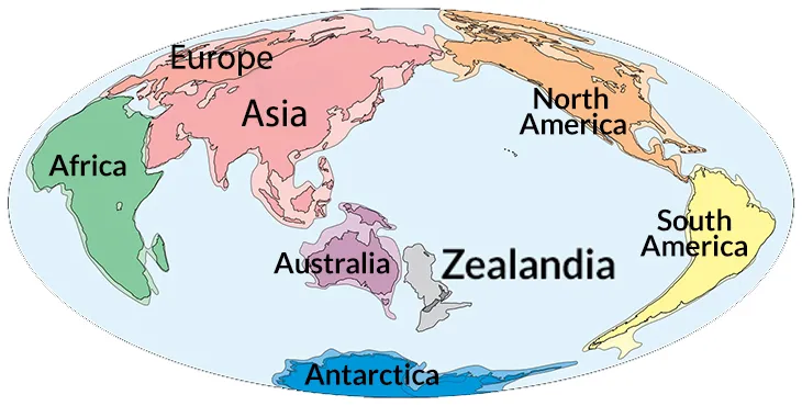
Geologists have confirmed the location of a lost continent beneath the South Pacific Ocean. Dubbed Zealandia, this vast territory covers approximately five million square kilometres, although 95% of its surface remains submerged.
The formation of Zealandia is linked to the supercontinent Gondwana, which more than 100 million years ago encompassed what we know today as South America, Africa, Antarctica, Australia and regions of Asia.
According to Nick Mortimer of the GNS Science Institute, who leads several studies on this territory, Zealandia began to separate from Gondwana about 85 million years ago.
Initially, this land remained above sea level, but various tectonic changes caused its crust to thin and eventually sink underwater. “Today, it remains mostly out of sight, but its presence has significant scientific value,” Mortimer noted, according to Earth.com.
Although some geologists had proposed for decades that this hidden region was continental in nature, many remained skeptical, arguing that it was plate fragments or submarine uplifts.
However, new studies supported by advanced techniques, such as geochronology, have provided compelling evidence to classify Zealandia as a continent.
According to scientists, this technique uses radioactive decay to determine the age of rocks, drawing a clear timeline of the region’s geological formation.
“By dating these rocks and studying the magnetic anomalies they presented, we were able to map the major geological units across North Zealandia,” the researchers detailed in a report according to Earth.com.
Magnetic data also played a crucial role in defining Zealandia’s shape and boundaries. Researchers identified consistent patterns linked to volcanic activity, demonstrating that this expanse is not just any oceanic terrain, but a region structured similarly to officially recognized continents.
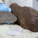
Samples collected using advanced dredging tools included sandstone, volcanic pebbles, and basaltic lava dating from the Early Cretaceous to the Eocene, according to the same website.
The process that led to Zealandia’s sinking is explained by the movement of tectonic plates. These are large sections of the Earth’s crust that slowly move and sometimes collide. When that happens, one plate can slide beneath another in what is known as a subduction zone.
In the case of this eighth continent, the thinning of the plate allowed the ocean to flood much of the territory, leaving only a few points visible, such as the islands that make up New Zealand.
In addition to its significant impact on the scientific community, this discovery has implications for understanding how continents evolve and the consequences plate movements have on sea level, climate, and biodiversity distribution.
“Zealandia’s underwater status in no way diminishes its geological significance,” said a GNS Science researcher. According to Earth.com, sediments at the site, which date back to the Late Cretaceous, suggest that parts of the continent remained above water for a long time before becoming completely submerged.
While Zealandia is notable for its size and structure, other similar formations have also drawn interest from geologists. Its large area and consistent features make it one of the most distinct submerged landmasses under study as a possible microcontinent.
Technologies such as seismic imaging and deep-sea drilling could reveal more details about its internal configuration, its history, and the impact it has had on terrestrial and marine ecosystems over millions of years.
As further exploration of Zealandia progresses, researchers hope to gain insights that support other theories about continental drift and the combined effects of tectonic plates on land redistribution.
According to Earth.com, these studies could further redefine the classification of continents and provide new insight into how the planet’s surface has formed throughout its history.